Apr 19th, 2026 - Conditions Report

Spring Skiing at Its Prime!
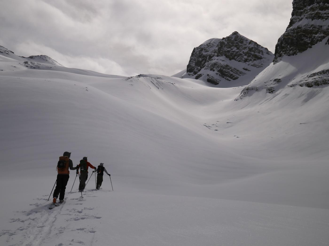
Join us for Private Ski Guided Days hunting those sweet corn turns, travel high up on the glaciers, or ski mountaineering objectives in the Bow Valley and 93N.
If you're looking for a multi-day adventure, connect with us about
our Wapta Ski Traverses or winter backcountry camping trips on the Columbia Icefield.
SNOWPACK & AVALANCHE CONDITIONS REPORT
Bow Valley and the 93N - April 19th, 2026
Spring has arrived, and arguably the most coveted stretch of the Rockies ski season is here. There’s a reason spring is such a favourite around here. The days get longer, and after a full winter of building, the snowpack is often at its most mature. Add in the daily rhythm of melt and refreeze, and spring has a way of turning conditions into something that feels full of opportunity. Over the past few weeks, conditions along 93N, with a small amount of time in the Bow Valley Corridor, have shifted decisively into that spring pattern. We’ve picked up a modest amount of new snow over the course of April, roughly on the order of 40 cm, but the bigger story has been diurnal change driven by temperature and solar input. Winds have generally been lighter, and wet loose avalanche activity has become the most consistent thread in our observations as the season begins to reach its final act.
GENERAL OBSERVATIONS
Over the past few weeks, spring conditions have become increasingly widespread across 93N and the Bow Valley corridor. The clearest expression has been below treeline and near treeline, where melt and refreeze cycles are now a daily driver on most aspects, and solar influence is beginning to reach higher into the alpine on south-facing terrain. That said, the classic “coveted” spring skiing still exists in pockets, and higher north-facing alpine terrain has generally continued to hold dry snow, offering a more winter-like feel when conditions line up.
Refreeze has been reasonably reliable overall, though it has varied day to day. When it has come together, mornings have offered supportive travel conditions, with surfaces evolving quickly as the day warms. Ski quality has reflected this spring split well, with corn developing on solar aspects and preserved dry snow lingering on higher north aspects.
From an avalanche perspective, wet loose activity has been the dominant theme in observations from the field, and cornice failures have also remained part of the conversation as temperatures rise. To date, our guides have not observed any wet slab activity during this period, though wet loose avalanches have been a consistent feature as surfaces lose strength through the heat of the day.
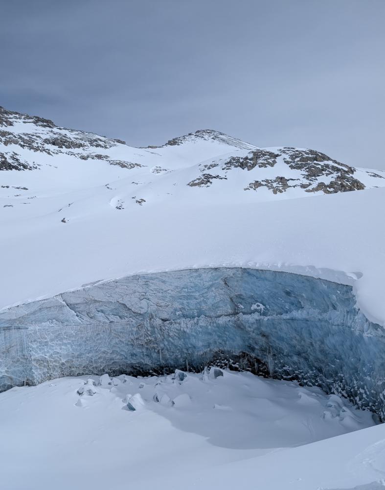
Exposed glacial cave on the 93N
DIRECT SNOWPACK OBSERVATIONS
In the past couple of weeks, our guides have generally found up to roughly 25 cm of settled storm snow sitting on the surface in many locations, with more pronounced wind effect in alpine terrain. Total snow depths have remained healthy for this time of year, with snow depths around 200 cm near treeline in the areas we travelled. On the glaciated terrain we’ve been exploring, our guides have consistently found roughly 2.5m to 3m+ of total snow depth. Below the upper snowpack, much of the remainder of the snowpack has continued to feel dense, strong, and well settled.
Recent April storm snow has arrived in a few separate pulses, and in many places now overlies a variety of spring crust interfaces. On solar aspects, sun crusts can be found up to ridgeline, while on colder aspects a temperature crust has been observed below approximately 2300 m. These crusts have become key structural features in the upper snowpack as spring continues to take hold and daily melt and refreeze cycles become more consistent.
Several older layers are still identifiable deeper in the snowpack. In recent observations, the March 20 interface has commonly been found down roughly 60 cm, while the January 24 interface can still be found much deeper, on the order of 150 cm down in some locations. While these layers remain present as markers of the season’s progression, the deeper snowpack below them has generally remained uniform, supportive, and well consolidated.
As spring conditions have become more widespread, surface conditions have continued to change quickly over the course of the day. Below treeline, snow surfaces have often transitioned toward wet, heavy conditions as warming progresses, while near treeline and into the alpine, corn development on solar aspects has been a more consistent feature when timing lines up.
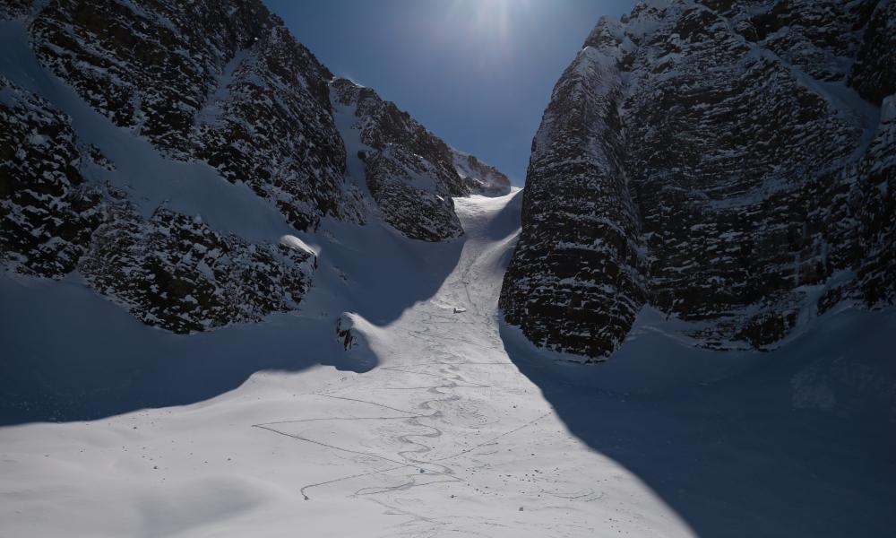
A skiier enjoying some April powder
AVALANCHE OBSERVATIONS
Avalanche activity during this period has been relatively limited based on what our guides have observed in the field. The primary theme has been wet loose avalanches releasing out of steep, rocky solar terrain as surfaces lose strength through the heat of the day. These have generally been small and closely tied to short-term warming and solar input.
On north-facing aspects, our guides have noted occasional sluffing associated with skier traffic, particularly in steeper terrain where preserved dry snow remains present. Outside of these observations, there has been little additional avalanche activity to report during this period.
WHERE WE WENT AND WHERE WE DIDN'T
Over this period, our guides spent the majority of their time operating along the 93N, with a smaller amount of time in the Bow Valley Corridor. Compared to earlier in the season, a greater proportion of days have involved alpine travel and time on glaciated terrain, reflecting the more spring-like snowpack and longer days that have begun to define April.
As spring conditions have become more widespread, terrain choice has increasingly been shaped by temperature and solar input. When warming and solar effect were a concern, our guides limited time spent beneath overhead hazard in steeper terrain and placed an emphasis on travel that matched the day’s conditions as they evolved. At the same time, many days included a balance between seeking solar terrain when it was producing quality corn surfaces, and looking for preserved dry snow on higher, north-facing aspects when conditions allowed.
THE OUTLOOK
Looking ahead, forecasts suggest a short-term warming trend followed by another cooling phase, continuing an oscillating pattern that, on average, aligns well with a typical spring diurnal rhythm. A bit of additional new snow is also expected at times, which should help keep surface conditions feeling more forgiving and maintain a buffer against overly firm surfaces as spring continues to take hold.
As the season progresses, our guides will be watching closely for the first major warm-up that occurs without a strong overnight recovery. That transition tends to be a useful stress test for how the snowpack is handling sustained heat, how quickly surfaces begin losing strength through the day, and how wet avalanche problems respond once melt becomes more continuous.
Thanks to everyone who’s been following along with the Guide’s Line Blog this season. Sharing what we’re seeing in the field is one of our favourite ways to stay connected to the broader mountain community, and we appreciate everyone who takes the time to read along.
With spring now firmly in the driver’s seat, it feels like a natural point to sign off for the season and let the mountains do the rest of the talking.
Our guides will likely be out enjoying the spring magic that the Rockies bring until our feet have had our fill of ski boots and things transition into summer.
Until next time,
— The C9G's