Feb 21st, 2026 - Conditions Report

Come Enjoy the Fresh Snow with us
on our Private Ski Guided Days available in the Bow Valley and 93N,
as well as Rogers Pass, Revelstoke, and Fernie.
SNOWPACK & AVALANCHE CONDITIONS REPORT
Bow Valley and the 93N - February 21st, 2026
Welcome back to the Guide’s Line Blog as we take a look at how the past two weeks have quietly reshaped conditions across the Bow Valley, Spray Valley, and 93N. Valentine’s Day has come and gone, and in true Rockies fashion it delivered what we tend to love most this time of year: fresh snow, along with what we’re perhaps slightly less fond of... a return to seriously frigid temperatures.
While not a major reset, a recent upslope event added new snow to the surface, with totals varying notably across the region. Areas through the Spray Valley saw accumulations approaching 30 cm, while the Bow Valley and 93N picked up more modest amounts. The result was a welcome refresh to ski quality in many locations, especially where snowfall totals were more generous.
Structurally, however, much of what we outlined in our previous post remains in place. The observations below reflect how this recent snowfall and temperature shift have layered onto an otherwise steady mid-winter snowpack.
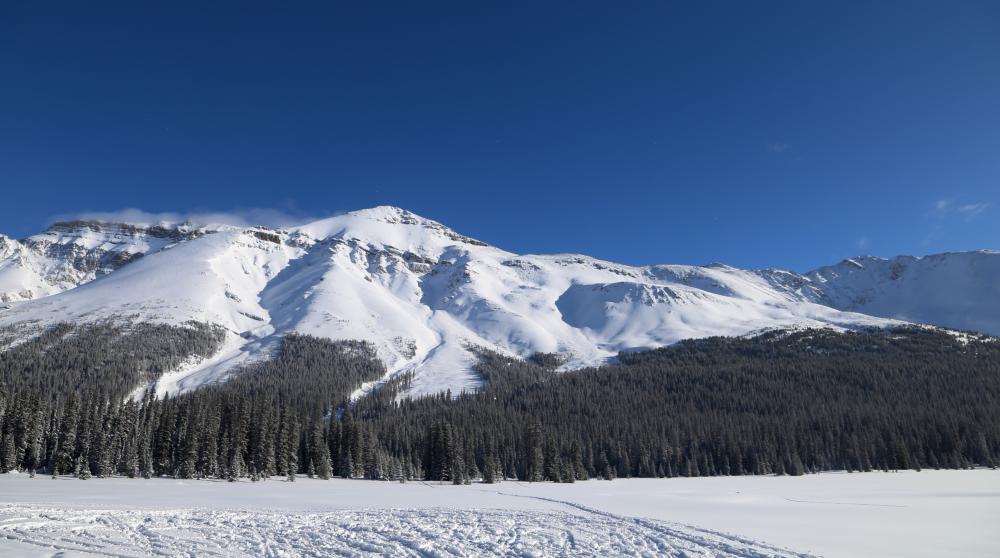
Bow Summit in all its glory
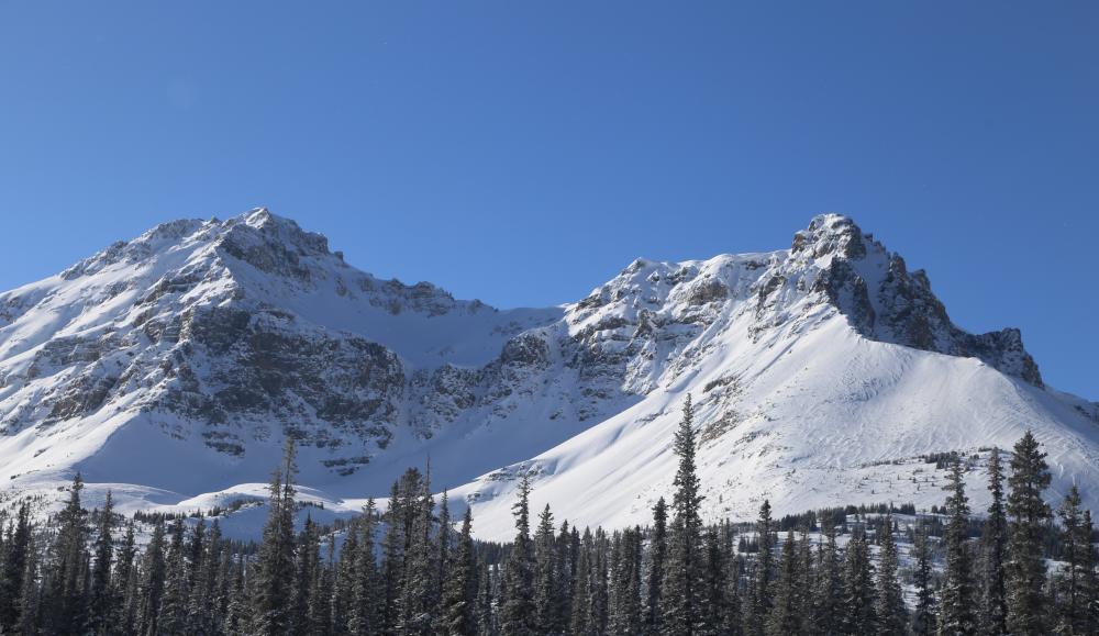
Observation Peak basking in the sun
GENERAL OBSERVATIONS
Since our last update, the broader pattern across the Bow Valley corridor and southern part of the 93N has remained fairly consistent. The upslope snowfall provided a meaningful refresh to surface conditions across the region, and ski quality improved broadly rather than only in isolated pockets. Even where accumulations were modest, the added snow helped smooth older surfaces and restore a more consistent feel underfoot.
Cold temperatures following the storm played an important role in preserving that improvement. Surface snow has remained generally dry and well preserved, particularly in sheltered terrain. At the same time, as the season progresses and solar input increases, south-facing slopes are beginning to show more pronounced diurnal influence. A melt-freeze surface crust associated with the prior drought period now sits beneath the most recent storm snow in many areas, creating a subtle but noticeable interface in the upper snowpack.
Wind was present during and after the storm, though less severe than some of the events that defined January. Wind effect can still be found, particularly in alpine terrain, where small wind slabs and firmer surfaces developed in exposed features. However, sheltered and lee terrain has remained comparatively pleasant, with preserved soft snow offering some of the more consistent skiing of the past two weeks.
From a hazard perspective, conditions have remained largely in line with what was outlined in our previous post. The new snow and wind introduced localized variability, but overall feedback from the snowpack has not suggested a major shift in the broader picture.
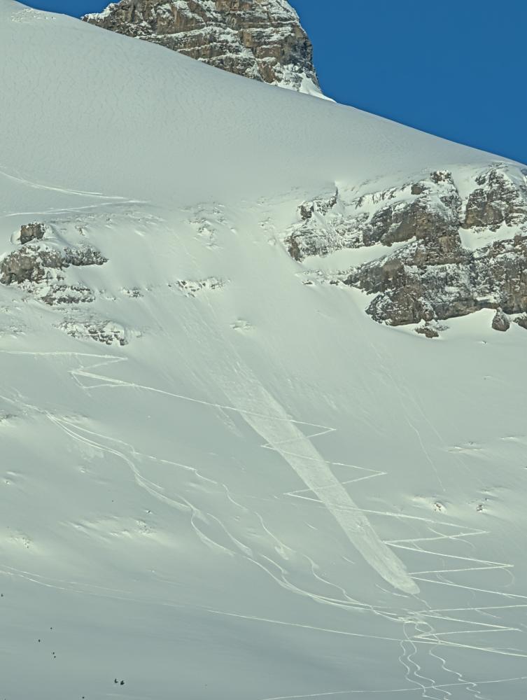
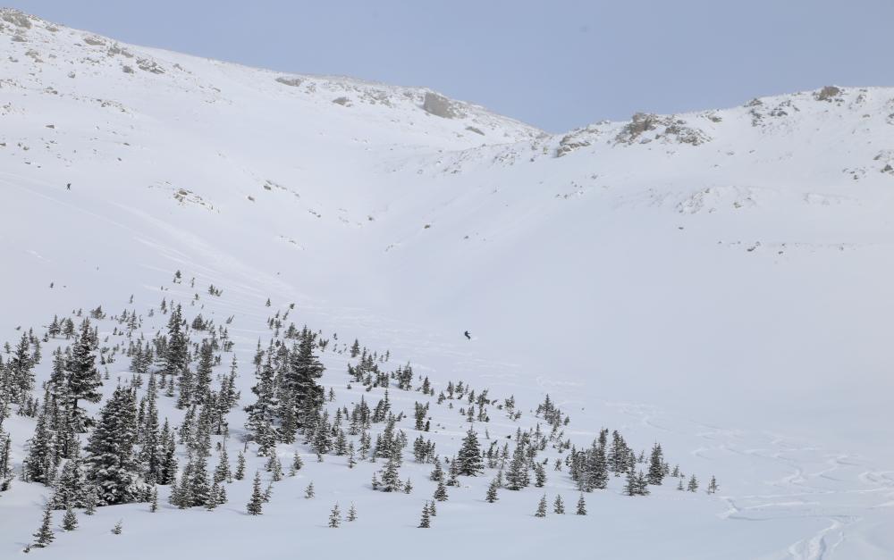
Evidence of a natural avalanche on the 93N. (20260220)
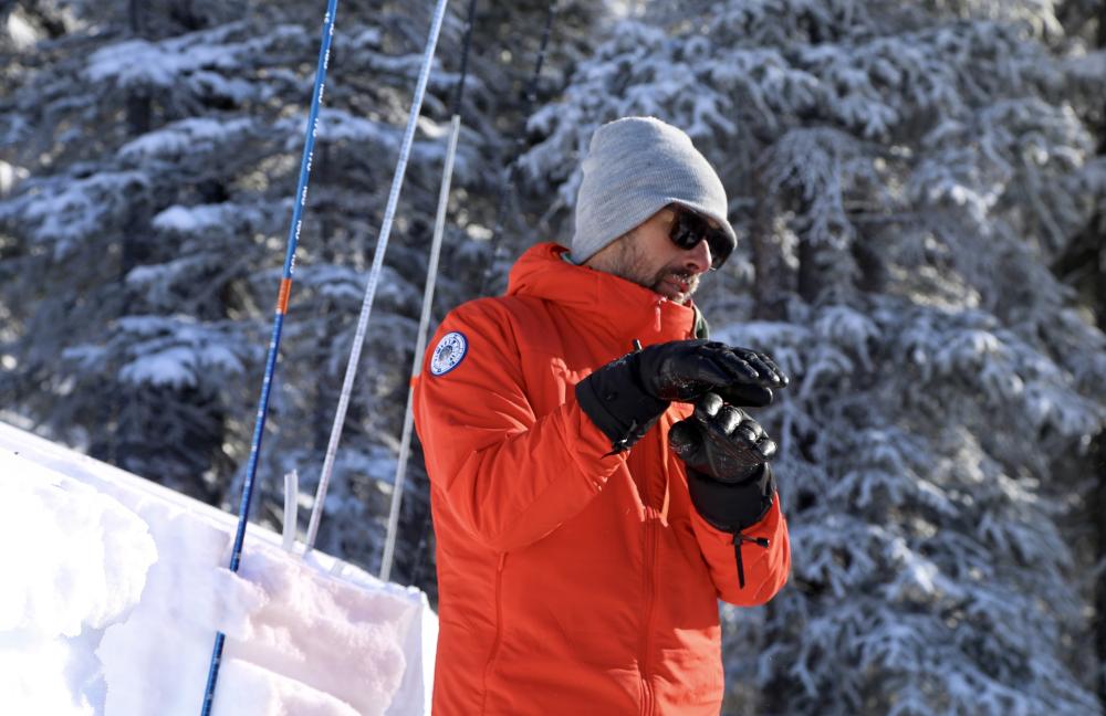
Daren Vonk explaining the nuances of an ECT
DIRECT SNOWPACK OBSERVATIONS
Over the past two weeks, our guides observed a modest refresh to the upper snowpack, with storm totals generally in the range of 30 to 40 cm in the Bow Valley corridor, and closer to 15 to 20 cm along 93N. At treeline, total snow depths have generally been around 150 cm in the areas our guides travelled. Cold temperatures following the storm helped preserve surface conditions and limited rapid settlement in many areas, while solar aspects continued to show more noticeable surface evolution as seasonal input increases.
In sheltered terrain, surface conditions commonly consisted of dry facets and decomposing fragments, with occasional small pockets of very small surface hoar. Beneath the most recent storm snow, our guides also noted a spattering of smaller drought layers that formed during the warm spell discussed in our previous post and persisted through to roughly Valentine’s Day. These layers have not shown notable reactivity in our observations and, over time, have been trending toward a more homogeneous upper snowpack. On steeper solar aspects, a melt-freeze surface crust remains present and has been observed across a wide range of elevations in the terrain travelled.
Persistent weak layers in the upper snowpack continue to be part of the conversation, though their expression varies by region. The January 24 layer remains present and has typically been found down roughly 20 to 40 cm. The January 3 layer can still be found deeper, generally down approximately 50 to 80 cm, though it appears increasingly sporadic in many locations. In a test profile near Sunshine Village on an east aspect at treeline, our guides produced an ECTP27 on the January 3 interface, failing on 2 mm facets down approximately 50 cm. While this interface was initially characterized more by surface hoar earlier in the season, our guides have noted that much of this surface hoar has now faceted out. Both layers have appeared more prominent around Sunshine Village than along 93N.
Lower in the snowpack, conditions have generally remained dense and well settled. In many locations, snow below roughly 80 cm to 1m has been supportive and relatively uniform in character. Older basal facets associated with mid-November weather events can still be found toward the base of the snowpack, though they have not featured prominently in recent day-to-day observations.
Sunny powder turns on the 93N
AVALANCHE ACTIVITY
Avalanche activity over the past two weeks has been limited, with two observed avalanches along 93N. The first was a size 2 avalanche on an east-facing alpine slope that initiated as a small, thin wind slab before entraining a larger amount of loose snow as it descended (see photo on the left). The second was a size 1.5 wet loose avalanche on a steep, rocky, west-facing slope.
Outside of these isolated observations, our guides did not note additional avalanche activity during recent field days.
In the Bow Valley Corridor, our guides did observe localized signs of reactivity, including whumpfing and shooting cracks. These observations were most commonly noted in flatter below treeline terrain, where surface hoar may have been better preserved.
WHERE WE WENT AND WHERE WE DIDN'T
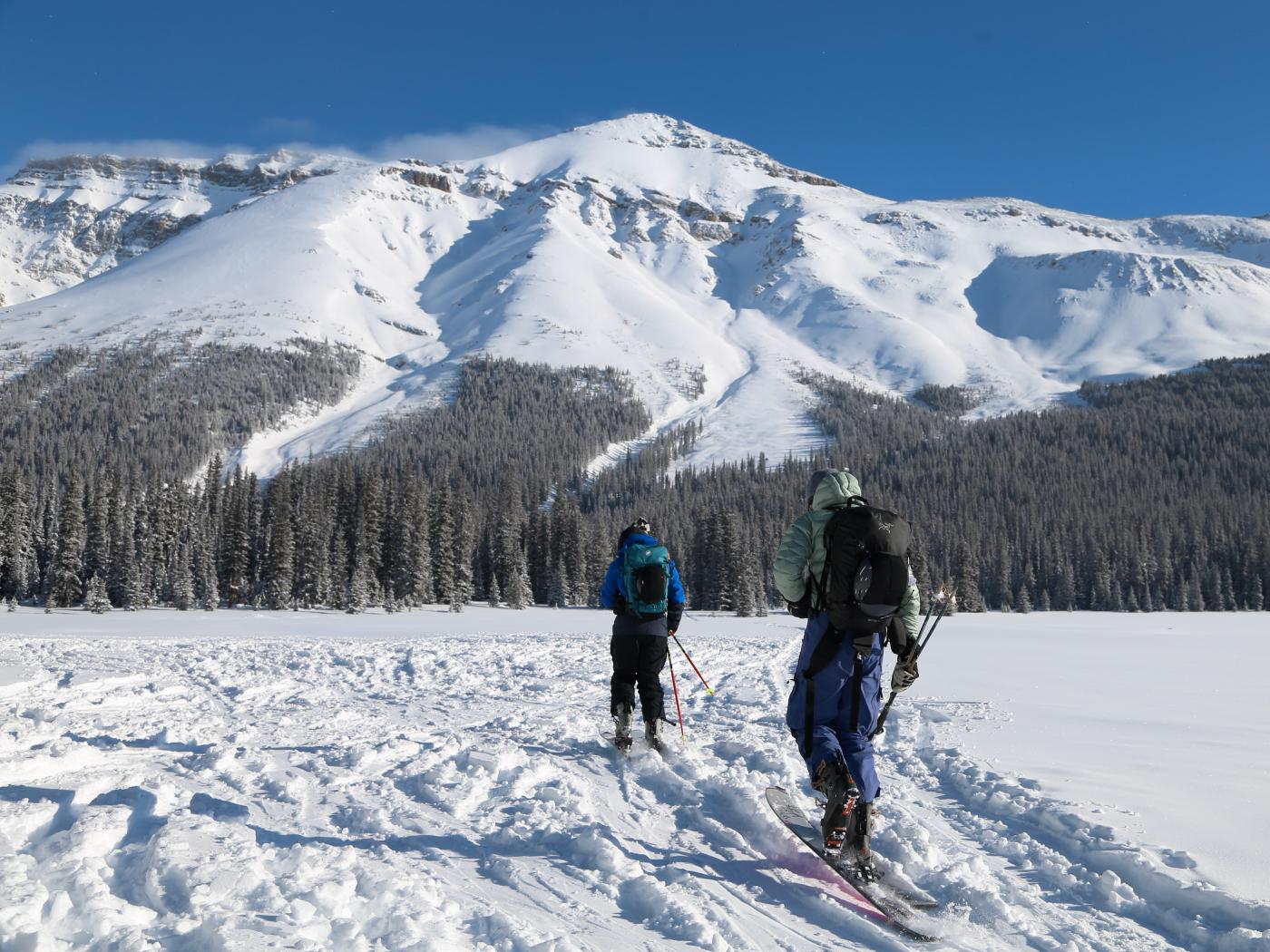
Over the past two weeks, our guides spent time operating across the Bow Valley Corridor and 93N. Travel and observations spanned all elevation bands, from below treeline through treeline into the alpine, with conditions and weather often shaping where meaningful time was spent on a given day.
In general, sheltered and lee terrain continued to be a common focus, both for ski quality and for consistency in surface conditions. With the combination of persistent wind effect in exposed terrain and increasing solar influence as the season progresses, the most pleasant riding and the most representative observations were often found away from heavily wind-affected features and away from steep solar terrain where crust development was more pronounced.
This period also came with a few clear limitations. Extremely cold temperatures made prolonged time in shaded terrain less appealing on many days, and in the Bow Valley, steeper terrain was often limited to reduce exposure to isolated pockets where surface hoar may have been better preserved. Similarly, terrain showing signs of wind loading or slab character was generally de-emphasized during field days, with observations often gathered from adjacent or lower-consequence features when possible.
THE OUTLOOK
Looking ahead, our guides are tracking a relatively steady temperature trend in the near term, with the potential for another larger storm to move through on a more typical southwesterly flow. After that, forecast models are hinting at another notable dip in temperatures, continuing the pattern of short-lived inputs followed by colder settling periods.
From a snowpack perspective, the broader themes remain largely unchanged from our previous post. The team will be watching how upcoming wind and new snow interact, particularly to see if wind slab problems become more widespread or more consistently expressed in exposed terrain. We’ll also continue paying attention to surface hoar where it exists, especially in areas where it may have been preserved through recent weather.
That’s all for now. We’ll be back with the next update in a couple of weeks. In the meantime, our team will be operating remotely for a stretch, heading down toward Nelson, and we’re looking forward to sharing what we see from that corner of the province.
- The C9G's