Feb 6th, 2026 - Conditions Report

Looking Ahead to the Rest of Winter
Join us for Private Ski Guided Days in the Bow Valley and 93N, as well as Rogers Pass, Revelstoke, and Fernie.
Or explore the glaciated landscapes on our Wapta Ski Traverse programs.
SNOWPACK & AVALANCHE CONDITIONS REPORT
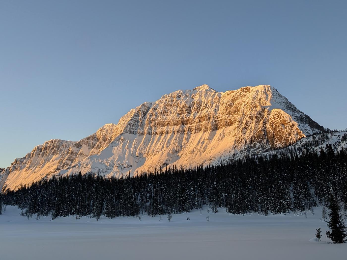
Bow Valley and the 93N - February 6th, 2026
Hello and welcome back to the Guide’s Line Blog, and to our first post of 2026. January has kept us all busy so far, and with a lot of time spent out in the field, it felt like a good moment to pause, zoom out, and start sharing some of what we’ve been seeing as we push further into the winter.
Time in the field throughout the Rockies, from stretches along the Icefields Parkway to days closer to home in the Bow Valley corridor, offered a front-row seat to a month shaped more by transitions than by big, defining storm cycles. In many ways, January continued a trend we’ve seen throughout this season so far, with conditions unfolding in ways that have felt a little outside the norm for a typical Rockies ski winter.
Despite that, the month carried a fairly steady rhythm overall. Many days were less about reacting to headline changes and more about paying attention to how conditions subtly evolved over time. That steady undercurrent sets the context for the observations that follow as we look back on how January unfolded.
GENERAL OBSERVATIONS
Taken as a whole, January unfolded in a way that felt familiar in some respects, but noticeably different in others. While the month was relatively dry by Rockies standards, that alone wasn’t unusual. What stood out more clearly was how the snowpack responded to those conditions. January’s colder period did drive faceting within the snowpack, as would be expected, but this year there was enough snow already in place that it avoided becoming a major setback. Rather than delivering a damaging reset, the snowpack largely absorbed that cold spell and, once temperatures moderated, settled back into the seasonal pattern of mild temperatures and rounding that has defined much of this winter so far.
Ski quality reflected that same balance. Throughout January, our guides encountered a wide range of conditions, with stretches of very enjoyable skiing interspersed with periods where surface conditions were less cooperative. Despite limited new snowfall, there was no shortage of both good and challenging riding to be found, often dictated more by timing, slope aspect, and wind effect than by fresh snow totals alone.
From a weather perspective, January was shaped primarily by a lack of sustained snowfall, an early warming event, and frequent moderate to strong winds. While that initial warm spell had a more pronounced impact in regions farther west, it still played a role locally in setting the tone for the month. Persistent wind left a clear imprint on surface conditions and snow distribution, while extended dry periods allowed surface hoar to form in many areas before eventually being buried. Overall, our guides found that January presented a generally stable backdrop, punctuated by occasional outlier events tied to short-lived weather inputs.
These patterns showed up consistently across much of the terrain we travelled, with local variation largely tied to wind exposure and aspect rather than broad regional differences. As a result, close, day-to-day observations remained important for understanding how conditions were expressing themselves at smaller scales, even when the broader picture appeared relatively consistent.
Taken together, January had a slower, more measured feel than the opening weeks of the season. Rather than being defined by singular events, conditions evolved incrementally, rewarding attention to detail and day-to-day changes. For our guides, this created space to observe how the snowpack adjusted between weather inputs and to build a clearer picture of how this winter continues to develop beyond the early-season volatility.
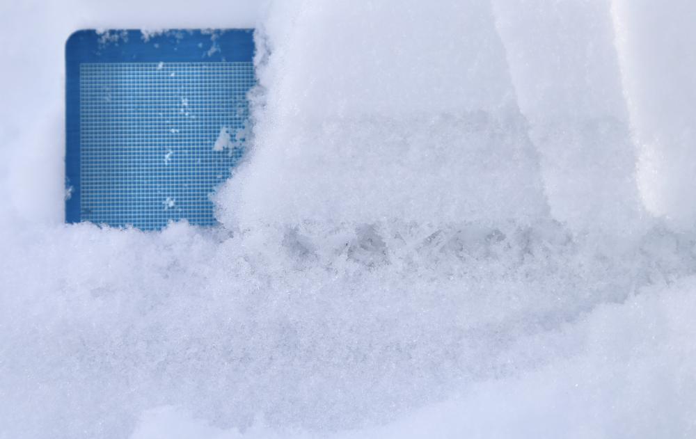
A side view of the Jan 24th Surface Hoar layer.
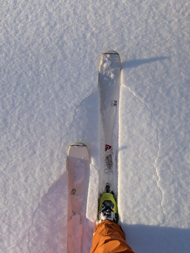
Cracking snow underfoot.
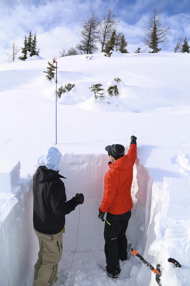
Demonstrating how to prepare an ECT (Extended Column Test)
DIRECT SNOWPACK OBSERVATIONS
Across January, our guides consistently found a snowpack that felt unusually robust for this point of the winter. Average snow depths across the areas we travelled were generally around 150 cm, providing a settled and supportive base that stood out against what is often a more fragile mid-winter structure in the Rockies. In most places, the snowpack presented as largely right-side up and supportive, with strength concentrated near the surface and fewer abrupt transitions than might typically be expected.
The colder stretch early in the month did promote faceting, as it often does, but its overall impact was muted. With sufficient snow already in place, the cold snap did not deliver the kind of widespread damage that can set a season back. As temperatures moderated, much of the snowpack transitioned back toward rounding, particularly through the mid-pack, which by late January was dominated by rounded grains and showed signs of ongoing settlement.
Near the ground, basal facets associated with mid-November weather events remained present. These layers, formed around November 17 and 23, were generally large-grained and rounding. While they continued to exist at the base of the snowpack, they did not feature prominently in our day-to-day observations through January and showed little change during this period.
Higher in the snowpack, surface hoar played a more active role in shaping structure. Two primary surface hoar layers were noted by our guides over the course of the month. The earlier January 3 layer was typically found 30 to 60 cm below the surface, with distribution and reactivity that remained highly variable and, in many locations, dormant. A more recent surface hoar layer, the January 24th, has been observed in more isolated pockets. Both layers were most commonly encountered near treeline and in sheltered terrain, where conditions allowed surface hoar to form and persist prior to burial.
Wind continued to be a dominant force in defining surface conditions throughout January, particularly in alpine terrain. Frequent wind events redistributed available snow, stripping exposed features and building hard wind effect across many aspects, with more recent wind events building small wind slabs in alpine lee features. As a result, surface conditions were uneven and strongly tied to exposure, with pronounced differences between wind-affected and more sheltered areas. While storm layers from early and late January were identifiable within the snowpack, their expression was inconsistent. In many locations, differences in local snowfall amounts played a greater role in shaping slab properties than storm loading alone, leading to wide variability in slab thickness and cohesion across the landscape.
AVALANCHE ACTIVITY
Avalanche activity throughout January remained limited based on what our guides were able to observe during time in the field. No natural or human-triggered avalanches were directly observed during guiding or personal days throughout the month.
That said, our guides did note shooting cracks within surface snow in areas where the January 24 layer was present and where sufficient snow existed to form a slab. These observations provided localized feedback on snowpack reactivity, rather than evidence of widespread avalanche activity. Where avalanche activity did occur during the month, it was generally limited to small wind slabs forming after notable wind events in more extreme terrain.
WHERE WE WENT AND WHERE WE DIDN'T
Throughout January, our guides spent the majority of their time operating along the Icefields Parkway and within the Bow Valley corridor. Travel was focused primarily near treeline, with more limited forays into alpine terrain. Upper alpine terrain was generally de-emphasized during the month, particularly given the extent of wind effect that developed through January.
Within the terrain we travelled, sheltered and lee features were often prioritized, largely for ski quality purposes. These areas tended to preserve softer snow surfaces and provided more consistent travel during a period when wind and sun exposure had a pronounced influence on conditions elsewhere. Focusing on these features also allowed for meaningful observation within terrain that remained representative of the broader snowpack structure discussed above.
At the same time, certain terrain was intentionally limited during January field days. Steep solar aspects with well-developed sun crusts were often avoided, as were areas that had been heavily wind affected or stripped down to firmer surfaces, which were common features across the region through much of the month.
THE OUTLOOK
Looking ahead, our guides are tracking a shift away from the recent warm spell, with cooler temperatures anticipated in the near term. Current forecasts suggest a return to more seasonable conditions, with the potential for some new precipitation and a period of reduced wind compared to what has defined much of January. How these changes materialize will play an important role in shaping surface conditions as we move forward.
From a snowpack perspective, our guides expect wind effect to remain a recurring influence, particularly in exposed terrain, while recent and future temperature swings may introduce new crusts at the surface. The team will also be paying close attention to how existing surface hoar layers evolve over time and respond to additional weather inputs.
Overall, January leaves the snowpack in a position that feels manageable and relatively well set up heading into the later winter months. While conditions will continue to change, the broader structure coming out of mid-winter suggests a foundation that could support a productive spring if similar trends persist.
January has been a month of adjustment more than acceleration, and those transitions have offered useful insight into how this winter is taking shape. As we move forward into the latter half of the season, we’ll continue to spend time out there, paying attention to how conditions respond to new weather and longer-term trends. We’ll share more as those stories develop.
— The C9G's