Dec 12th, 2025 - Conditions Report

Winter has Arrived!
Join Us for Early Season Fun in the Backcountry on our AST 1, Rockies AST 2, or Rogers Pass AST 2 Courses, AST Connect+ Days, or Private Ski Guided Days in the Rockies and Beyond.
SNOWPACK & AVALANCHE CONDITIONS REPORT
Lake Louise, and the 93N - December 12th, 2025
Hello and welcome back to the Guide’s Line Blog, delivering our final blog post before the holiday season. It feels as though Ol’ St. Nick arrived a few weeks early this year, bringing with him a series of storm cycles that have caused a noticeable shift in conditions across the Canadian Rockies. After a relatively quiet start to the season, these storms have helped reset the landscape and firmly usher winter into the mountains.
With that shift now well underway, it felt like the right time to step back into the field and take stock of how things are shaping up. The observations below reflect what our guides have been seeing across a mix of guiding and personal days, capturing a snapshot of current conditions as the season continues to take form.
GENERAL OBSERVATIONS
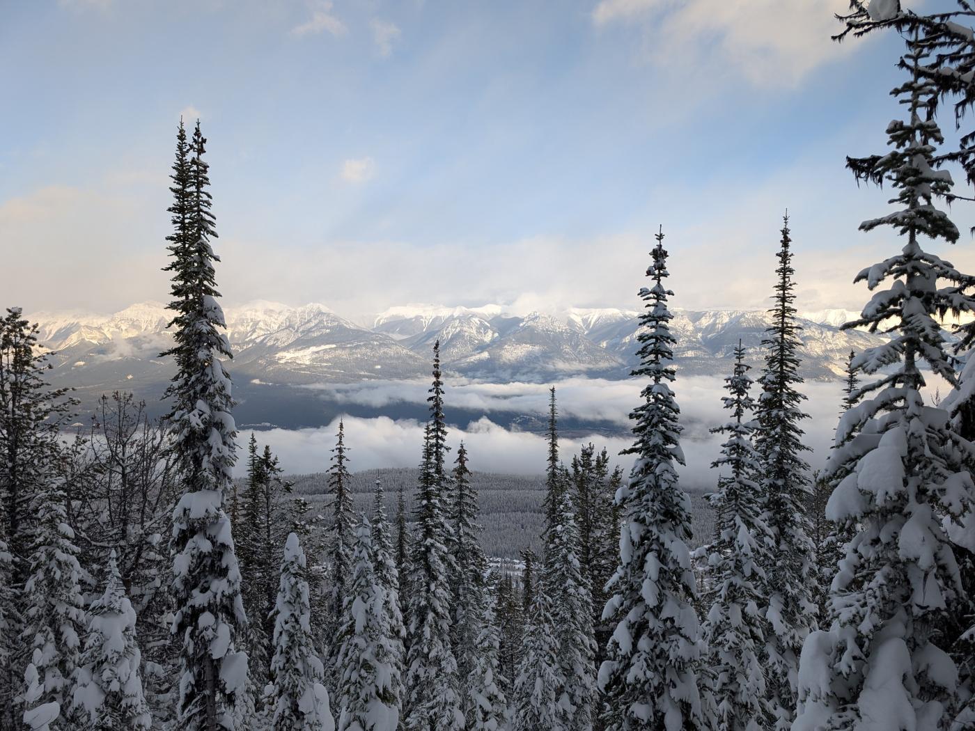
Following a relatively quiet start to the blog cycle period, the past week in particular marked a noticeable turning point in conditions across the Bow Lake and Peyto Lake area, where our guides have spent the majority of their time. A series of storm cycles moved through the region, reshaping both the skiing experience and the character of the snowpack in a way that was consistently noted during recent field days.
At the risk of introducing the hyperbole warned of in Blog Post 01, our guides did indeed find excellent ski quality, with recent snowfall significantly improving surface conditions. In observed areas, storm totals reached up to approximately 50 cm, creating some of the most enjoyable riding seen so far this season.
These storms arrived with strong, typically southwesterly winds and relatively warm temperatures, influencing how new snow settled and interacted with underlying layers. Across recent field days, wind slab features were more commonly observed than a broad storm slab issue. In terrain less affected by wind, our guides noted only limited signs of direct instability within recent storm snow. Compared to the previous post, our guides observed an upward trend in hazard over the past week, coinciding with recent snowfall and wind.
DIRECT SNOWPACK OBSERVATIONS
Across recent field days, our guides encountered a snowpack shaped by several storm cycles over the past week, with observed storm totals commonly ranging from 40 to 70 cm across the area. In locations where we stopped to examine the snowpack, approximately 60 to 80 cm of recent storm snow was present above older mid-November layers. The upper snowpack was strongly influenced by storm loading and wind transport, particularly following periods of sustained southwesterly flow. These conditions remained broadly consistent across multiple days, despite “incremental” changes associated with continued snowfall and wind (relatively speaking).
Recent storm snow generally formed a thick, soft slab that showed variable bonding to underlying layers. In the terrain travelled, our guides did not encounter widespread storm slab behaviour. Only limited cracking was observed, and this was typically small in scale. Slab character was most apparent in wind-affected features, particularly in exposed terrain near treeline, where signs of wind loading were more evident. In sheltered areas, recent snow remained soft and lacked cohesive slab characteristics.
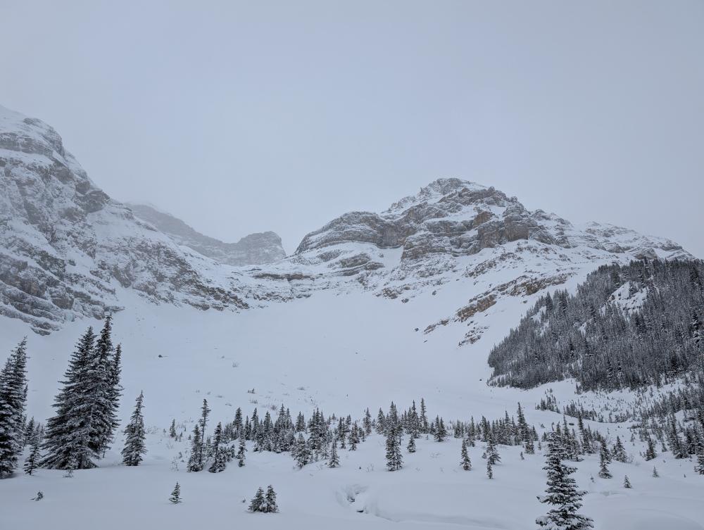
At lower elevations, older interfaces associated with mid-November weather events, including a rain crust observed below approximately 2100 to 2300 m, were present within the snowpack, though they did not feature prominently in our day-to-day observations during this period. Visibility during several field days was limited due to ongoing storm conditions, which constrained surface observations in some areas.
AVALANCHE ACTIVITY
Our guides did not observe any avalanche activity during recent field days. Visibility was frequently limited due to ongoing storm conditions, and travel was constrained as a result, which reduced opportunities to observe avalanche activity across the broader landscape. Our guides note, however, that the lack of observed avalanche activity during this period should be viewed in the context of limited visibility and constrained travel, which reduced opportunities to observe activity across the broader landscape.
WHERE WE WENT AND WHERE WE DIDN'T
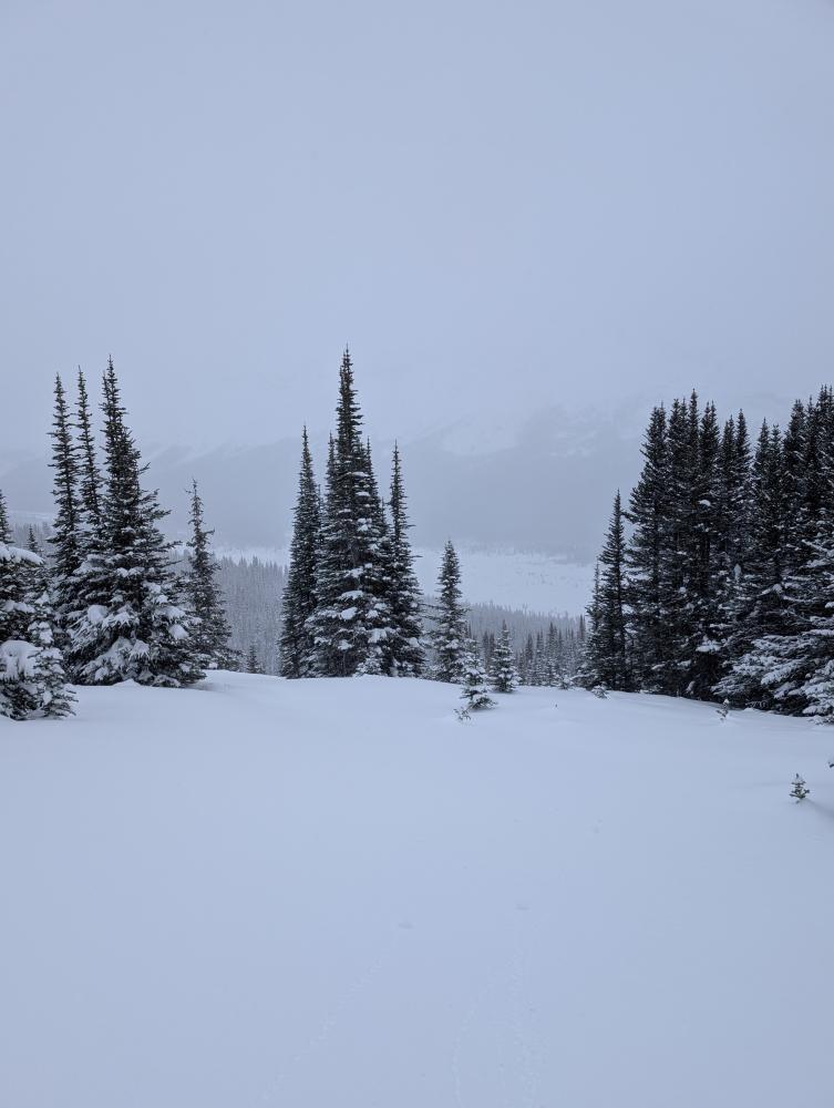
As mentioned earlier, over recent field days our guides spent the majority of their time operating in the Peyto Lake and Bow Lake area, with travel largely focused in treeline and below-treeline terrain. This allowed for consistent movement and observation while remaining engaged with the snowpack changes associated with the most recent storm cycles. Within these zones, our guides generally travelled through smaller terrain features, lower-angle slopes, and areas characterized by simpler terrain shapes.
As a result, the majority of travel occurred within terrain that would typically be described as Simple, with only limited use of Challenging terrain where conditions and visibility allowed. Time spent in more exposed or committing terrain was minimal throughout this period. Where steeper or more complex features existed within the operating area, they were observed from a distance rather than travelled directly.
THE OUTLOOK
Looking ahead, our guides are tracking a brief warm spell expected to move through over the weekend, followed by a return to more active weather. Current forecast models suggest a resumption of storm cycles beyond that point, with some scenarios indicating the potential for significant additional snowfall, on the order of 50 to 100 cm over the next ten days. As with recent periods, wind is expected to remain a key component of these systems.
From a snowpack perspective, our guides anticipate that conditions will continue to evolve primarily in response to new weather inputs. Recent storm snow and wind-affected layers will have time to adjust during any short breaks between systems, though any additional loading would be expected to influence both snowpack structure and overall hazard. How this balance unfolds will depend largely on the timing, intensity, and character of upcoming storms.
As always, thanks to everyone who’s been following along and engaging with these updates. Sharing what we’re seeing in the field is an important part of how we stay connected to the broader mountain community, and we appreciate the conversations that come out of it.
With winter now firmly underway and more weather on the horizon, we’ll be keeping a close eye on how the season continues to develop. We’ll be back in the new year with further observations as conditions evolve. Until then, we wish everyone a great holiday season and some quality time outdoors!
The C9G's